The Nature Trust of BC – 50 years of conservation

Since 1971, The Nature Trust of British Columbia has taken a leadership role in land conservation. We have protected ecologically significant land, as well as championed initiatives to advance land conservation in B.C. This legacy timeline highlights some of our significant accomplishments within the context of the environmental movement.

We are grateful for the guidance of our volunteer board, the dedication of our staff and the support of our many partners and donors who have helped keep nature in our future.

The Movement Spurs Action

The beginning of the environmental movement is widely credited to Rachel Carson’s 1962 book Silent Spring that drew attention to the impact of chemicals on the environment.


  • 1970, The first Earth Day was celebrated by 20 million people in New York.
  • 1970, The U.S. Environmental Protection Agency is established.
  • 1971, Canada establishes the Department of the Environment. The Honourable Jack Davis, MP Coast-Capilano from British Columbia is appointed the first Minister of Environment.
  • 1971, The National Second Century Fund is established, which becomes The Nature Trust of BC in 1984.

Activism in BC

Groups advocate to protect crown land in B.C. from development and resource extraction.

Two important initiatives:

  1. The development of the Biogeoclimatic Ecosystem Classification (BEC) system that underpins terrestrial ecosystem management and conservation planning. 1976 The BEC system was adopted by the BC Ministry of Forests.
  2. 1973, The establishment of the Agricultural Land Reserve.

The Founding of The Nature Trust

The National Second Century Fund of British Columbia is founded in 1971 with a $4.5 million gift from the Federal Government in honour of B.C.’s Centennial Celebration to protect habitat for wildlife, plants, fish and birds by acquiring ecologically significant private land.

At this time The Nature Trust managed lands through long term leases to local, federal and provincial governments. Strong links to provincial fish and wildlife staff were maintained to aid in managing conservation lands, and long term leases of NTBC lands to BC Parks began, with infill acquisitions adding to Okanagan Mountain Provincial Park and Cold Fish Lake in the Spatsizi Plateau Wilderness Provincial Park.

The National Second Century Fund becomes a registered charitable organization in 1971. A volunteer board of directors composed of scientists and business leaders is established.

The First Nature Trust Board of Directors

The first Chair of the board is former Major General, Bert Hoffmeister, a highly decorated Canadian Second World War hero, retired forestry executive and conservationist.

Bert Hoffmeister Portrait and Military Portrait

Hoffmeister remains Chair of the dedicated volunteer board of business leaders and scientists for 20 years.

The founding scientist board members, Dr. Alistair McLean, Dr. Bert Brink, Roderick Haig-Brown, and Dr. Ian McTaggart-Cowan, are at the forefront in shaping the province’s approach to land conservation. Expert scientific opinion is used to identify which priority properties to acquire. Land management is still grounded in managing the land for big game and the forests for resource values.

Roderick Haig-Brown was instrumental in fostering an awareness of conservation in B.C. in the 1950s and 1960s that provides a foundation for the emergence of the environmental movement in the late 1960s. With burgeoning ecological concepts, Roderick Haig-Brown developed a critique of resource development based on the ethical responsibility of humankind for maintaining the integrity of ecosystems.  In addition to being one of The Nature Trust’s original board members, he was a magistrate, acclaimed author, fly fisherman and a pioneering conservationist.

The first full time employee of The Nature Trust was hired in 1978.

Selected Land Acquisitions of the 1970s

Since 1971 The Nature Trust has acquired more than 500 conservation properties.

Numbers identify each property on our interactive property map.

Click here to visit the map.

In the 1970s The Nature Trust’s land acquisitions are grouped in three types of projects:

  • Urban Fringe properties with marshes, such as Cranberry Lake in Powell River or Nature Sanctuaries focusing on education such as Scout Island at Williams Lake.
  • Estuarine, riparian and wetland properties focusing on waterfowl and fish resources such as Widgeon Slough in the Lower Mainland, the first Englishman River acquisition on Vancouver Island, the initial property on the lower Adams River in BC’s Dry Interior, and the first Columbia River Wetlands acquisition in the East Kootenay.
  • Big game properties for ungulate winter range such as our very first acquisition in Grand Forks.

The Nature Trust has expanded many of these conservation areas over the past 50 years.

1972 Grand Forks #1

The Nature Trust of BC's first land acquisition, purchased to conserve low elevation grasslands, a rare ecosystem in BC.

Fall grasslands at Grand Forks

The first land acquisition by The Nature Trust of BC was a 196 hectare (483 acres) property located near Grand Forks. The property was purchased to conserve low elevation grasslands, a rare ecosystem in BC covering less than 1% of the land base, and winter range for bighorn sheep.

1973-1988 Scout Island #3

The Scout Island Nature Centre was built on this land and provides an excellent nature education experience for thousands of school children, residents of the Cariboo-Chilcotin, and tourists.

The Nature Trust acquired 10 hectares (25 acres) near Williams Lake. The Williams Lake Field Naturalists, with support from the City of Williams Lake, have been managing this conservation area for its habitat and nature appreciation values. The Scout Island Nature Centre was built on this land and provides an excellent nature education experience for thousands of school children, residents of the Cariboo-Chilcotin, and tourists.

1975-2008 Buttertubs Marsh #15

This project was to conserve a freshwater marsh.

View of Buttertubs Marsh with water and brown vegetation leading to a mountain covered in trees

The Nature Trust acquired 23 hectares (57 acres) at Buttertubs Marsh, in the centre of Nanaimo. This project was to conserve a freshwater marsh. These lands are part of Buttertubs Marsh Park, where approximately 75,000 people walk along a 2 km loop each year to experience and connect with nature. Not only is the marsh a wildlife sanctuary important for several migratory birds, it provides an essential ecosystem service of storm water management to the city.

1976 -1985 Roderick Haig-Brown - Adams River #13

This acquisition was the catalyst to create the Tsútswecw Provincial Park previously known as the Roderick Haig-Brown Park.

Red Sockeye Salmon swim up river to spawn at Adams River

From 1976 to 1986, The Nature Trust of BC acquired 6 properties encompassing 48 hectares (118 acres) of land along the Adams River. This acquisition was the catalyst to create the Tsútswecw Provincial Park previously known as the Roderick Haig-Brown Park. The Adams River is a tributary to the Thompson and Fraser Rivers and is internationally recognized for having one of the largest annual sockeye salmon runs in North America with a dominant run every four years featuring millions of spawning salmon. Roderick Haig-Brown was a magistrate, acclaimed author, fly fisherman and pioneering conservationist. He also provided his expertise to The Nature Trust of BC as one of the early board members.

1977 Addington Point Marsh #19

This conservation property was an early project to protect land near to urban areas of the Lower Mainland.

Clouds Reflect off the water in the marsh with green vegetation surrounding the water

In 1977, The Nature Trust of BC purchased 258.4 hectares (639 acres) at Addington Point Marsh from Colonel Clarence Wallace, a former Lieutenant-Governor of BC. This conservation property was an early project to protect land near to urban areas of the Lower Mainland. Now part of the Pitt-Addington Marsh Provincial Wildlife Managed Area, Addington Point Marsh is visited by many people looking to experience wildlife in the densely urbanized area of Metro Vancouver. Addington Point is used primarily by marsh-associated birds such as trumpeter swan and great blue heron and mammals such as black bear and mule deer.

1978-2021 Englishman River and Englishman River Estuary #25 #124 #126 #148

The estuaries and foreshore zones provide vital rearing habitat to Pacific salmonid species, while the river systems provide crucial habitat to spawning salmon, steelhead and coastal cutthroat trout.

Aerial view of the englishman river with fall colours in the trees

For 40 years, The Nature Trust of British Columbia has been acquiring and managing land along the beautiful Englishman River, from the headwaters to the estuary in Parksville-Qualicum Beach on Vancouver Island. The Nature Trust of BC has acquired 340 hectares (841 acres) to help keep this river system healthy for fish, wildlife and community drinking water. The estuaries and foreshore zones provide vital rearing habitat to Pacific salmonid species, while the river systems provide crucial habitat to spawning salmon, steelhead and coastal cutthroat trout.

Over 250 species of birds, have been reported within the protected area. The intertidal habitat in the estuary supports thousands of migrant waterfowl along the Pacific Flyway and provides critical winter staging grounds for Brant, a Pacific goose that breeds in coastal areas of Alaska and the Canadian Arctic. The Nature Trust helps coordinate the annual Brant Wildlife Festival each spring in the Parksville Qualicum Beach area to raise awareness of the importance of this long stretch of beach to Brant and other wildlife. Mammals such as black bear, river otter, mink, marten, deer, elk, cougar and water shrews depend on the protected area for their survival as do many reptiles and amphibians.

1978-1999 Harrison-Chehalis #23

The Heart of the Fraser is recognized as one of the most productive river regions in the world.

Looking out over a wetland with purple foxglove flowers in the foreground

The 201 hectare (497.7 acres) Harrison-Chehalis conservation complex is located along the Harrison River, a side-channel of the Fraser River near Chilliwack, forming a key part of the 1033 hectare Lhá:lt / Harrison-Chehalis Wildlife Management Area. The floodplain and channels of the lower Fraser River between Mission and Hope is called the Heart of the Fraser, it is also known as the Gravel Reach. This is where the Fraser River emerges from the canyon and flattens out causing the gravel and sediment to settle out. The Heart of the Fraser is recognized as one of the most productive river regions in the world. This stretch of gravel is crucial habitat for white sturgeon (provincially Red-listed, and national COSEWIC Threatened status), along with chinook (with the Harrison population considered as Threatened by COSEWIC), chum, pink, and other salmonids. The area is also internationally significant for migrating birds. The Nature Trust has protected 282 hectares in total between Mission and Hope.

Consequence of Consumption

The 1980s see a splintering of the environmental movement by the mass consumption of everything from energy and detergents to plastics and pesticides. This decade is often remembered for its materialism and consumerism.

The Ozone Hole

Scientists discover the ozone layer is thinning in the lower stratosphere, with dramatic ozone loss, known as the "ozone hole”, in the Antarctic spring during September and October.


  • The Montreal Protocol is signed by Canada, the U.S., Japan, and 21 other countries, agreeing to phase out industrial use of ozone-depleting chemicals (CFCs) by the year 2000.
  • The World Meteorological Organization and the United Nations Environmental Program establish the Intergovernmental Panel on Climate Change (IPCC). The IPCC provides balanced scientific information regarding climate change and will release Assessment Reports in 1990, 1995, 2001, and 2007. The panel will be awarded the Nobel Peace Prize for its last Assessment Report in 2007.
  • 1988, Canada hosts the World Conference on the Changing Atmosphere in Toronto, one of the earliest global meetings on the topic.

A Focus on Conservation

The significant economic development in B.C. during the 1970s and 1980s brings into focus challenging land use issues and growing concern about pollution.


  • The World Conservation Strategy of 1980 is the first international document produced with inputs from governments, non-governmental organizations, and other experts arguing that for development to be sustainable, it should support conservation rather than hinder it.
  • This period marks the movement’s formal entry into politics with the founding of the Green Party of Canada in 1983.
  • “Without biodiversity, there is no future for humanity,” says Prof David Macdonald, at Oxford University. The term is coined in 1985 – a blend of “biological diversity”.
  • 1985, Ducks Unlimited launches the North American Waterfowl Management Plan (NAWMP), a 15-year multi-million dollar effort to conserve wetlands in North America.
  • 1989, World Wildlife Fund Canada launches its 10-year national Endangered Spaces Campaign to complete a network of protected areas representing all terrestrial natural regions of Canada. This effort more than doubles the number of protected areas across the country.
  • 1989, The North American Wetland Conservation Act is signed by U.S. President, George Bush. One of the primary objectives of the Act is to encourage partnerships to conserve North American wetland ecosystems for waterfowl, other migratory birds, fish, and wildlife. This is a funding mechanism to protect wetland habitat in U.S., Canada and Mexico.

The Nature Trust Leads Partnerships for Conservation

1984, The National Second Century Fund’s name changes to The Nature Trust of British Columbia.

1987, The Nature Trust takes a leadership role with other conservation partners and federal and provincial government departments to establish the Pacific Estuary Conservation Program (PECP) for the purpose of acquiring, protecting and enhancing estuaries along the B.C. coastline. Some of The Nature Trust PECP projects include the Cowichan River estuary, Nanaimo River estuary, Englishman River estuary and south arm marshes of the Fraser River delta.

1988, the Vancouver Island Conservation Land Management Program (VICLMP) is established to deliver on the ground support for the PECP. This program is now called the West Coast Conservation Land Management Program. Through this program, The Nature Trust works with Ducks Unlimited Canada, Environment and Climate Change Canada – Canadian Wildlife Service, the Province of BC, and the Habitat Conservation Trust Foundation in a geographic area that covers Vancouver Island, B.C.’s central coast, and Haida Gwaii. The Nature Trust cost shares a land manager for this program, which commenced in 1991 and continues today.

Selected Land Acquisitions of the 1980s

Since 1971 The Nature Trust has acquired more than 500 conservation properties.

The Nature Trust acquisition plan focuses on natural habitats.

Numbers identify each acquisition on our interactive property map.

Click here to visit the map.

1980-2019 Columbia River Wetlands #32

The Nature Trust of BC has acquired 376 hectares (930 acres) in the Columbia River Valley to protect riparian and wetland ecosystems adjacent to or part of the Columbia National Wildlife Area and Columbia Wetlands Wildlife Management Area.

Columbia River Edgewater on a sunny day looking across the lake towards mountains

This large wetland complex along the Columbia River is a Ramsar-designated Wetland of International Importance because of the diversity of habitats for wildlife and being a key stopover for migratory birds along the Pacific Flyway.  This complex of conservation properties also protects dry open forest upland providing landscape connectivity for large mammals and other wildlife. The most recent acquisition was Columbia River Wetlands – Edgewater.

1983-2006 Vaseux Lake #46

The Nature Trust of BC acquired 13 properties to create the 484 hectare (1,197 ac) Vaseux Lake Complex.

Geese fly over Vaseux Lake at sunset

The initial land was purchased to protect important bighorn sheep habitat in an area of the Okanagan that would have been otherwise greatly developed, extending protected habitat to areas adjacent to the Vaseux-Bighorn National Wildlife Area. Rocky cliffs, outcrops and talus slopes on the complex are of particular importance, as they provide essential habitat for bighorn sheep, in addition to supporting snake dens, bat roosts and nesting sites for canyon wrens and white-throated swifts. As the complex of lands around Vaseux grew, so did the benefits to other wildlife. Vaseux Lake and its surrounding land is designated as a Federal Migratory Bird Sanctuary offering habitat for many waterbirds, such as trumpeter swan, and dense riparian shrubland for yellow-breasted chat (an Endangered bird).

1985- 1986 Bummers Flats #59

The Nature Trust acquired 988 hectares (2,441 acres) at Bummers Flats in the East Kootenay to protect a vital waterfowl staging and nesting area along the Pacific Flyway and habitat for elk, moose, grizzly bear and a variety of at-risk bird and mammal species including American badger and American bittern.

Cherry Creek along Kootenay River with fall colours and mountains reflecting in the water

It is one of the few lowland protected sites in the Rocky Mountain Trench.

The property is named after the area known as Bummers Flats. This name originates from the mining days of Wild Horse Creek. There were those who made their own way and some who rode on the backs of others. Some would camp in the vicinity where they “bummed” drinks and meals from the more affluent and generous minded.

1987 Boundary Bay #73

The Nature Trust protected 32 hectares (79 acres) at Boundary Bay at the foot of 72nd Street in Delta.

Looking down the shore with water, sand a and grass

Located on the Pacific Flyway, Boundary Bay is an internationally recognized Important Bird Area that provides essential habitat for migrating birds and supports the largest wintering shorebird and waterfowl populations in Canada. This property is part of the Boundary Bay Wildlife Management Area. Visitors to this area can enjoy walking or cycling on several kilometres of dyke trails.

Climate Change and Biodiversity Loss Take Centre Stage

1990, A United Nations report underlines the importance of climate change as a challenge with global consequences requiring international cooperation and warns that global temperature rise will occur at a rate of 0.3°C per decade unless CO2 emissions are reduced worldwide.


  • 1992, The Convention on Biological Diversity (CBD) also known as the Rio de Janeiro Earth Summit, opens for signature at the United Nations Conference on Environment and Development on June 5th. Canada is the first industrialized country to sign and ratify the CBD, which now includes 196 nations. The Convention on Biological Diversity (CBD) is the international legal instrument for the conservation of biodiversity, the sustainable use of its components and the fair and equitable sharing of the benefits arising out of the utilization of genetic resources.
  • 1997, Climate change draws international attention with the adoption of the Kyoto Protocol. The protocol requires nations to reduce greenhouse gas emissions — the gases responsible for climate change.
  • Much of the public advocacy in B.C. during the early 1990s is trained on major battles on the forested landscape such as Clayquot Sound and the Great Bear Rain Forest.
  • The land conservation movement is maturing in B.C. with a significant increase in the number of local and regional land trusts.

A Focus on the South Okanagan

1990, The Nature Trust is instrumental in prioritizing management activities for the conservation of natural habitat in the South Okanagan together with provincial and federal environment ministries and other non-government organizations and foundations.

The resulting Habitat Atlas for Wildlife at Risk and the Conservation Strategy for the South Okanagan helps establish the basis for the South Okanagan Conservation Program partnership.

On the recommendation of board members Alastair Maclean and Dr. Bert Brink, The Nature Trust focuses acquisition efforts and resources on the South Okanagan, an area with high conservation values and at high risk of being lost to urban development and agricultural expansion.

In 1993, Land management grows in importance. The Nature Trust hires its first regional conservation land manager for the South Okanagan.

More Data is Needed

1991, The Nature Trust helps establish the B.C. Conservation Data Centre (CDC).

The B.C. CDC assists in the conservation of the province’s biodiversity by collecting and sharing scientific data and information about wildlife and ecosystems in B.C. The B.C. CDC is only weeks old when a major conference regarding provincial biodiversity, called The Living Legacy, is held in British Columbia. This starts the B.C. CDC on an ambitious plan to compile and analyze information on the rare vascular plants, vertebrates, and forested ecosystems of the province.

The Ecological Gifts Program

1995, the Federal government establishes the Ecological Gifts Program to provide tax incentives to land owners who donate their ecologically significant land to a land trust or other organization for conservation.

This program eliminates the taxable capital gain on the disposition of these properties and the tax credit from the gift can be applied to 100 per cent of the taxable income and forward up to 10 years.

The Nature Trust is the first B.C. recipient of an Ecological Gift.  It has now received 56 Ecological Gifts (or EcoGifts) of land – the largest number of any land trust in B.C. –protecting almost 9,000 acres –  3,625.4 hectares (8,958.6 acres) through this program.

Protection for Private Forest Land

Towards the end of the 1990s, the need to protect forest land for biodiversity is recognized.

The Nature Trust is the sole delivery agent for the Forest Renewal BC Private Forest Biodiversity Program.  This program funded projects such as Francis Point on the Sunshine Coast and Mount Maxwell on Salt Spring Island.

Selected Land Acquisitions of the 1990s

Since 1971 The Nature Trust has acquired more than 500 conservation properties.

Bigger is Better!

The Nature Trust begins to focus on expanding conservation areas to increase resiliency of protected ecosystems, at a landscape level, rather than acquiring isolated properties.

Numbers identify each property on our interactive property map.

Click here to visit the map.

1990-2003 Big Ranch #89

The Nature Trust of BC acquired this 484 hectare (1,196 acres) property near the Elk River.

Rolling grass hills, lined with trees and rugged mountains in the background

The property contains a diverse range of habitat, from old growth black cottonwood and spruce forests to open grassland habitat. This habitat diversity supports many wildlife species ranging from raptors to large mammals, including moose, elk, cougars, black bears, and grizzly bears, along with the Endangered American badger. Elk are the most abundant ungulates (hoofed mammals) using the conservation property, as it provides critical winter range for up to hundreds of these animals. Elk congregate on and around the property from late fall until early spring each year. The bordering Elk River is a regionally significant fish-bearing river that contains populations of the Blue-listed Westslope cutthroat trout, rainbow trout and the Blue-listed bull trout.

1993-2018 Okanagan Falls Biodiversity Ranch #100 and the White Lake Basin Biodiversity Ranch #113

The Nature Trust of BC has two biodiversity ranches: Okanagan Falls consisting of 791 hectares (1,955 acres), with 44,126 hectares (109,037 acres) of Crown grazing license managed as part of the ranch and White Lake Basin Biodiversity Ranch consisting of 2,058 hectares (5.085 acres), with 6,032 hectares (14,905acres) of Crown grazing licenses and leased lands managed as part of the ranch.

Looking out across a still lake mirroring the hill in the background in the water.

White Lake Basin Biodiversity Ranch is The Nature Trust property complex with the highest ranked conservation value. The aim of the White Lake Basin Biodiversity Ranch is to conserve and restore natural grassland and associated ecosystems in ways that contribute to a contiguous, resilient landscape that supports a diverse, thriving community of native plant and animal species, and at the same time facilitate a viable domestic cattle ranching enterprise.

The Nature Trust works with ranching partners on each of these ranches. The Clifton family is our ranching partner on the White Lake Basin Biodiversity Ranch. “It’s important for two things. It’s important for us as far as being economically viable because without grass we can’t have cattle. The other part is because we are sustaining the grass where it is, we’re keeping all of the species that are there and allowing them to expand and survive. It’s a win-win for everybody,” Wade Clifton, said. The Clifton’s won the 2019 BC Cattlemen’s Association Ranch Sustainability Award and the Canadian Cattlemen’s Association 2019 Environmental Stewardship Award.

1996 Alice Arm Estuary #115

The Nature Trust of BC 56 hectares (138 acres) called the Alice Arm Estuary in northern BC, to conserve an important Pacific estuary, at the mouth of the Kitsault and Illiance Rivers.

The site contains a mixture of deciduous and coniferous forest adjacent to saltwater marsh. Lance-leaved mare’s tail (Red-listed) occurs in brackish side channels on the property, a plant that had not been found in BC before its observation in this estuary. The Red-listed eminent bluegrass has also been found in the estuary meadows, which previous to this observation had only been found near Kitimat in BC. Alice Arm estuary supports a rich and diverse range of bird species, with over 60 species spotted in a two-day survey, including rusty blackbirds (Special Concern), barn swallows (Threatened), and marbled murrelets (Threatened).

Science Documents a Changing Climate, Government Responds

Science magazine publishes NASA satellite survey of more than 2,000 glaciers showing that most are shrinking.


  • The effects of human impact on our earth are becoming more evident. The film, An Inconvenient Truth presents an illustrated talk on climate by former U.S. Vice-President, Al Gore, alerts the public to the exponentially increasing effects of global warming to our planet.
  • 2002, Canada ratifies the Kyoto Protocol. Canadian Prime Minister, Jean Chretien announces $1.3 billion in spending to comply with the Kyoto climate treaty.
  • 2004, Rapid climate change is occurring in the Arctic according to 300 scientists who worked for four years on the international Arctic Council and concluded that sea ice in the Arctic covered 10 per cent less surface area than 30 years earlier, and was about half as thick as it had been at that time.
  • 2008, B.C. is the first province in Canada (and jurisdiction in North America) to implement a carbon tax.

The Species at Risk Act

2002, The Species at Risk Act (SARA) becomes law in Canada.

The Act is designed to meet one of Canada’s key commitments under the International Convention on Biological Diversity. The purposes of this Act are to prevent wildlife species from being extirpated or becoming extinct, to provide for the recovery of wildlife species that are extirpated, endangered or threatened as a result of human activity and to manage species of Special Concern to prevent them from becoming endangered or threatened.

The Youth Movement

2005, Richard Louv's landmark book Last Child in the Woods: Saving Our Children from Nature-Deficit Disorder starts a national conversation about the disconnection between children and nature, inspiring Leave No Child Inside initiatives throughout the country.

2005, Montreal hosts the United Nations’ 11th annual Conference of the Parties (COP), where signatories to the United Nations Framework Convention on Climate Change meet to discuss progress in combatting climate warming. Prior to COP11, youth from around the world meet in Montreal. Together they create the first Conference of Youth. These conferences now take place annually in advance of the COP meeting.

The Nature Trust Grows in Response to a Changing Economic Environment

There is a greater understanding that conservation lands need to be managed to maintain the ecological values for which they were acquired.

Ecosystem restoration projects include removal of invasive weeds, thinning the growth of trees in dry forested sites, prescribed burns, and planting trees and other indigenous vegetation. Human use of these lands also needs to be managed.

  • 2000, The Nature Trust of BC hires a Provincial Conservation Land Manager in response to the increase in the number of Nature Trust acquisitions and the reduced capacity of the province to fulfill the conservation land management needs of the leases they hold on Nature Trust lands.
  • 2003, The Nature Trust hires a Land Manager for the East Kootenay.
  • 2002, The Nature Trust hires its first Habitat Ecologist.
  • 2002 – 2003, The Nature Trust hires its first fundraising manager and communications manager in response to the need to fund increasing land acquisition and management costs and the number of competing land trusts in the province.

Partnerships Grow and Mature

Partnerships evolve to include more members of established partnership programs, such as the Pacific Coast Joint Venture and Pacific Estuary Conservation Program.

New land conservation partnerships are created, including the South Okanagan-Similkameen Conservation Program, East Kootenay Conservation Program (later the Kootenay Conservation Program), and the Canadian Intermountain Joint Venture. Local government regional districts and municipalities play an increasingly larger role in the conservation of private land and are participating in a number of these partnership programs. The Nature Trust is a founding partner and plays a leadership role in these initiatives.

  • 2004, BC Trust for Public Lands is established. The provincial government provides a one-time contribution of $8 million to create a new public lands trust that supports conservation of ecologically important private lands for the benefit of the public in British Columbia.
  • 2005, the Conservation Land Forum is established with partners from Canadian Wildlife Service (CWS), Ducks Unlimited Canada (DUC), The Nature Trust of BC (NTBC), Nature Conservancy of Canada (NCC), The Land Conservancy of BC, Ministry of Environment, and the Ministry of Agriculture and Lands. The Nature Trust plays a key role in managing annual spatial data updates on B.C.’s conservation lands protected by NGOs, as well as mapping and distributing annual summaries of findings. The current General Working Group for managing these data include CWS, DUC, NTBC, NCC, and The Land Trust Alliance of BC (LTABC).

Taking Nature’s Pulse

The provincial government provided a one-time contribution of $8 million to create a new public lands trust that supported conservation of ecologically important private lands for the benefit of the public in British Columbia.

The Nature Trust is again at the forefront of a joint effort by government and non-governmental scientists to develop a science foundation to take action to conserve the province’s biodiversity.

2008 Taking Nature’s Pulse: The Status of Biodiversity in British Columbia, a 268-page report, is published. This report provides 23 major findings that highlight the most important considerations for the conservation of biodiversity in B.C. Taking Nature’s Pulse is the result of a collective effort over three years by more than 50 leading provincial and international scientists representing some of the best ecological thinking in B.C. The Nature Trust’s staff and Board scientists work tirelessly to bring the Biodiversity BC partnership together. NTBC’s Habitat Ecologist takes a lead role as co-chair of the Biodiversity BC Steering Committee since its inception in 2005 through to publication of Taking Nature Pulse.

Developing Tools to Improve Conservation

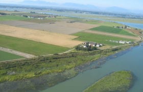
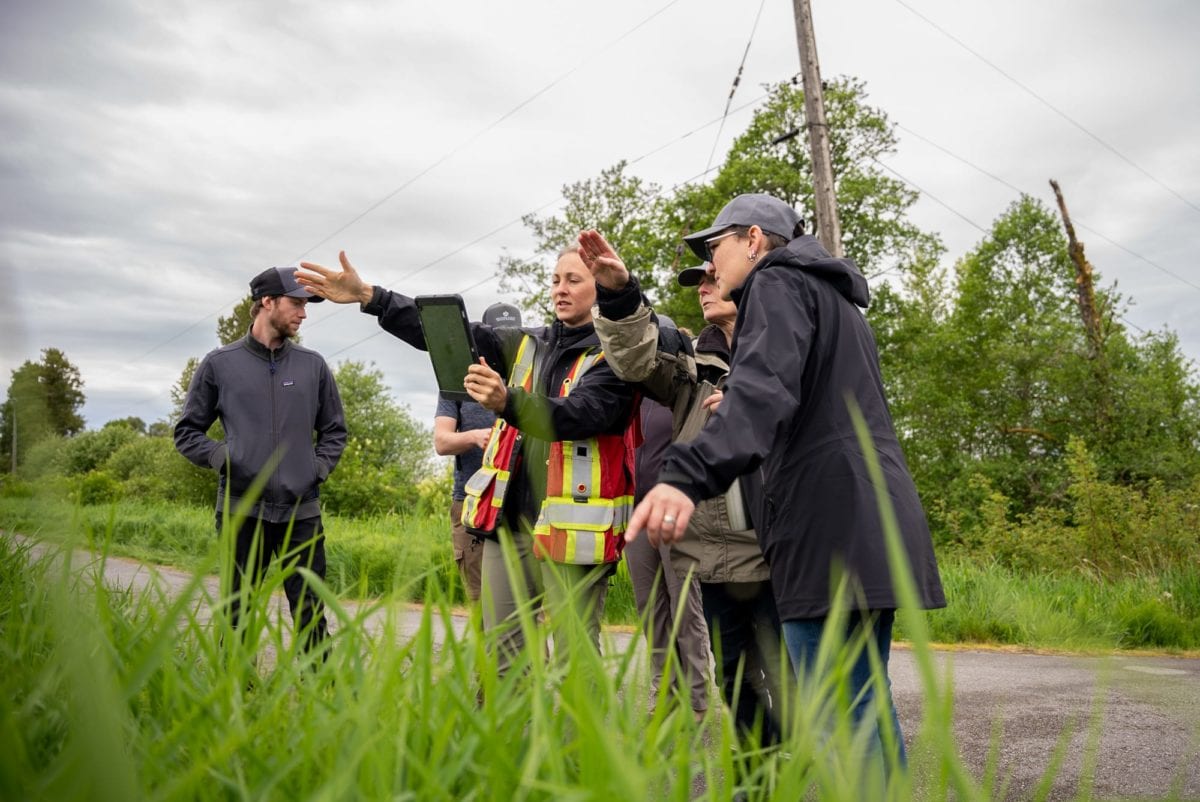
The Nature Trust and the Province initiated discussions on the need for a digitized conservation property layer and in 2002 included Ducks Unlimited Canada and Canadian Wildlife Service in the discussion to initiate a GIS project to spatially map conservation areas in BC.

In 2005, the Conservation Land Forum was established with partners from Canadian Wildlife Service (CWS), Ducks Unlimited Canada (DUC), The Nature Trust of BC (NTBC), Nature Conservancy of Canada (NCC), The Land Conservancy of BC, Ministry of Environment, and Ministry of Agriculture and Lands. The Nature Trust continues to play a key role by managing annual spatial data updates on conservation lands protected by NGOs in BC, along with mapping and distributing annual summaries. The current General Working Group for managing these data includes CWS, DUC, NTBC, NCC, and The Land Trust Alliance of BC (LTABC).

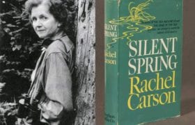
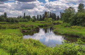
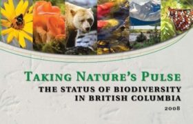
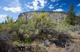
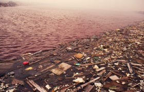
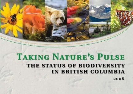
The Nature Trust was again at the forefront of a joint effort by government and non-government scientists which developed a science foundation on which to take action to conserve this province’s biodiversity. In 2008, Taking Nature’s Pulse: The Status of Biodiversity in British Columbia, a 268-page report, is published. This report provides 23 major findings that highlight the most important considerations for the conservation of biodiversity in BC. Taking Nature’s Pulse was the result of a collective effort over three years by more than 50 leading provincial and international scientists representing some of the best ecological thinking in BC. The Nature Trust’s staff and Board scientists worked tirelessly on bringing the Biodiversity BC partnership together. NTBC’s Habitat Ecologist took a lead role as co-chair of the Biodiversity BC Steering Committee since its inception in 2005 through to publication of Taking Nature’s Pulse.

Selected Land Acquisitions of the 2000s

Since 1971 The Nature Trust has acquired more than 500 conservation properties.

The Most Endangered BEC Zone:

Nature Trust of BC acquisitions during this decade focus on the most endangered BEC zone Coastal Douglas-fir, expanding existing complexes and add the largest single property parcel even today – the Hoodoos in the East Kootenay, as well as protecting Antelope-brush in the South Okanagan and properties and covenants under the federal government Ecological Gifts program.

Numbers identify each property on our interactive property map.

Click here to visit the map.

2000- Francis Point #118

The Nature Trust of BC acquired 73 hectares (180 acres) located at Francis Point on the Sunshine Coast in 2001.

Through a 99 year renewable lease to BC Parks, this property became designated as Francis Point Provincial Park. The Nature Trust continues to help fund the management of this special place. Francis Point Provincial Park showcases an excellent example of ecosystems within the Coastal Western Hemlock biogeoclimatic zone, which includes a fragile lichen and moss ecological community growing on the rocky outcrops.

2001-2011 Mount Maxwell #117

Salt Spring Island is noted for having several rare ecosystems, including excellent examples of Garry Oak woodland.

Garry Oak woodland is contained within the Coastal Douglas-fir biogeoclimatic zone, one of the rarest and most threatened biogeoclimatic zones in BC. The Nature Trust originally purchased several parcels in 2001 and then added one of the last pieces of private land on Mount Maxwell, near Burgoyne Bay on Salt Spring Island, in 2011. These properties encompass 296 hectares (731 acres) and are located in the Mount Maxwell Ecological Reserve.

2002-2018 Savary Island #119

The Nature Trust of BC purchased 50% of an undivided interest in 142 hectares (351 acres) on Savary Island.

With the help of the local community, the other 50% was acquired in 2018. This property features one of the best examples of coastal sand dunes in Canada and provides habitat for two at risk plants: Silky Beach Pea (Red-listed) and Contorted-pod Evening-primrose (Endangered).

2003 Hoodoos #123

The Hoodoos is a 3,922 hectare (9,690 acre) property- the largest single-transaction Nature Trust property acquisition.

The property is adjacent to the Dutch Creek Hoodoos- a landmark geological rock formation near Fairmont Hot Springs. This property protects a mosaic of forested and open habitats for deer, elk, badger and other mammals as well as a number of land birds (e.g. Lewis’s woodpecker) and migratory waterfowl. Given the property’s size and location, it represents an important east-west ecological corridor for movements of ungulates as well as providing important elk winter range.

2003-2016 Wycliffe Wildlife Corridor #127

This 364 hectare (899 acre) complex in the East Kootenay features a variety of ecosystems including open forests, grasslands and riparian areas.

Protection of grasslands is of international, national and regional significance. Only 1% of BC is covered with grasslands and this ecosystem supports 30% of BC’s species at risk. Grasslands have been lost due to development, agriculture, invasive species, and overgrazing. Grasslands were managed and maintained in the past by Indigenous peoples using regular low intensity burns to promote wildlife usage and conditions for culturally important plants. With fire suppression, conifer encroachment has resulted in a loss of large areas of native open grassland.  This conservation complex provides winter range for white-tailed deer, mule deer and elk.

2003-2016 Antelope-brush #128

Located near Oliver, this 152 hectare (375 acre) conservation complex protects the largest area of antelope-brush grassland in the south Okanagan outside of First Nations land.

Antelope-brush grassland is home to more than 20 species at risk and is considered to be one of the most endangered ecosystems in Canada. This project was acquired in phases and took 17 years to complete.

2005 MacMillan #131

This 28 hectare (70 acres) property near Port Alberni was donated to The Nature Trust of BC.

It features old growth forest and habitat for Roosevelt elk. It is now part of MacMillan Provincial Park, which is home to a famous, 157-hectare (390-acre) stand of ancient Douglas-fir, known as Cathedral Grove, drawing visitors from all over the world.

Climate Change Takes Centre Stage Internationally

Climate science alarm bells are ringing. Longer hotter dryer seasons and excessive rainy seasons, are first-hand effects climate change and the cause of severe fires and flooding.


  • The Intergovernmental Panel on Climate Change’s, fifth assessment, says climate scientists are 95 per cent certain that “human influence has been the dominant cause” of global warming.
  • 2017 is the second hottest year on record, after 2016, according to NASA and a European Union monitoring center. Copernicus scientists say 16 of the 17 warmest years have been in the 21st century.
  • Severe wildfires rage across California, causing an estimated $10 billion in damage, killing at least 86 people and destroying more than 18,000 buildings.
  • 2012, U.S. National Aeronautics and Space Administration (NASA) reports that the surface of Greenland’s ice sheet is going through the most extensive and rapid melt since satellite observations began 30 years before. Over a four day time period, 97 per cent of the surface ice has started melting, which is unprecedented. If fully melted, Greenland ice would raise world sea level by 20 feet.
  • 2011, Canada withdraws from the Kyoto Protocol, citing a number of reasons, including how far Canada lags behind the protocol’s targets. In the years that follow, the same administration makes it increasingly difficult for environmentalists and their organizations to operate in Canada. Scientific institutions are eliminated or have their federal government funding reduced, and the public’s access to scientific research becomes increasingly limited.
  • 2015, Canada and 194 other countries sign the Paris Agreement to fight climate change. Canada’s goal is to reduce Greenhouse Gas (GHG) emissions by 30 per cent below 2005 levels by 2030 and have net zero emissions by 2050. The Agreement outlines the ways in which the international community will cooperate to keep global warming to 1.5°C above pre-industrial levels. Nature plays an essential role in sequestering GHG when we protect and enhance forests, estuaries, wetlands and grasslands.

Biodiversity: Threats and Policies

New research, new policies:

  • 2010, a Strategic Plan for Biodiversity is adopted at the Conference of the Parties for the Convention on Biological Diversity (CBD).This plan includes 20 global biodiversity targets, known as the Aichi Targets, which each party to the convention has agreed to contribute to achieving by the year 2020. Canada, the European Community and the other 195 parties in this global plan are encouraged to develop their own national targets using the Aichi Targets as a guide.
  • 2014, the Federal government launches the National Conservation Plan, which provides a national vision and investments to conserve lands and waters, restore ecosystems, and connect Canadians to nature.  The Nature Trust acquires properties such as Twin Lakes (part of the White Lake Basin Biodiversity Ranch) and the Bull River Grassland Corridor. This later becomes the Natural Heritage Conservation Program under Canada’s Nature Legacy in 2018. The Nature Trust acquires the Salmon River Tidal Slough and Princeton Grasslands MapleCross Meadow Phases I and II under this revised program.
  • 2015, A global assessment reports bees and other pollinators are at risk of collapse from pesticides.
  • 2019, Research is published highlighting the unprecedented global biodiversity loss and the need to protect species. An estimated one million species are at risk of extinction due to the cumulative human impacts of habitat fragmentation, insecticide use, over harvesting, polluting, and introducing invasive species (United Nations Intergovernmental Science Policy Platform on Biodiversity and Ecosystem Service). Since 1970, the Living Planet Index notes that  half of our abundance of wild vertebrates—animals with backbones such as mammals, birds, reptiles, amphibians and fish) have been lost.

Politics and the Environment

In 2015, Canada appoints Catherine McKenna, the first Minister of Environment and Climate Change Canada and changes the department’s name from Environment Canada to include climate change.


  • 2015, Canada adopts a suite of national targets known as the “2020 Biodiversity Goals and Targets for Canada”. Target 1 states that by 2020, at least 17 per cent of terrestrial areas and inland water, and 10 per cent of marine and coastal areas of Canada be conserved through networks of protected areas and other effective area-based measures. At the end of 2019, Canada has only 12.1 per cent of its terrestrial area (land and freshwater) conserved and 13.per cent of its marine territory conserved.
  • 2014, A dam breaks at the Mount Polley mine in central British Columbia dumping 24 million cubic meters of water and mine tailings into Quesnel Lake.
  • 2015, Keystone XL veto — U.S. President Barack Obama vetoes a bill that would have allowed construction of the Keystone XL Pipeline from the Canadian tar sands to U.S. refineries.
  • The Republican Party wins a majority in the U.S. Senate and retains its majority in the House. Anti-environmental politicians now dominate science, energy and environment committees in both Houses for the first time in history. In 2016, Donald Trump wins the U.S. presidential election. His cabinet picks have strong ties to the oil industry.
  • 2016, A study by a team of scientists from China, Australia and the United States indicates a rise in global sea levels is accelerating and is now at 3.3 millimeters annually.
  • 2018, Greta Thunberg, a Swedish teen environmental activist who is internationally known for challenging world leaders to take immediate action against climate change, starts her public activism with school strikes.
  • 2019, For the first time, renewable energy generation surpassed coal use in the U.S., by 23 per cent to 21 per cent, according to a U.S. Energy Information Agency report.

Major Conservation Projects Led by The Nature Trust

The Nature Trust develops the Relative Ecological Assessment tool that uses provincial spatial data to help assess the ecological values and priority ranking for individual property acquisitions.

  • 2011, The Nature Trust helps to launch an updated version of the Columbia River Basin Biodiversity Atlas. The Biodiversity Atlas Project presents interactive spatial information about the Columbia River Basin wildlife species and their habitats to the research community, resource managers, local decision-makers, and public.
  • 2012, The Nature Trust helps to establish the Coastal Douglas-fir and Associated Ecosystems Conservation Partnership (CDFCP) as a forum for communication and collaboration regarding the maintenance and restoration of healthy Coastal Douglas-fir and associated ecosystems. The Nature Trust continues to serve on the Steering Committee of this partnership.
  • 2017, The Nature Trust helps to establish the South Coast Conservation Land Management Program. This program manages more than 37,000 hectares of provincially-designated conservation lands throughout the B.C. South Coast through an innovative partnership between the B.C. provincial government, Ducks Unlimited Canada, The Nature Trust of British Columbia, and the Canadian Wildlife Service of Environment and Climate Change Canada.
  • 2018, The Nature Trust hires its first Director of Conservation Land Securement.
  • The Nature Trust of BC is awarded a grant through the BC Salmon Innovation and Restoration Fund for a five year study Enhancing Estuary Resilience: An Innovative Approach to Sustaining Fish and Fish Habitat in a Changing Climate. This 2019-2024 project will monitor and assess estuary resilience to sea level rise at 15 sites on Vancouver Island, the central coast and Haida Gwaii and implement several major ecological restoration projects to restore core estuarine processes.

Selected Land Acquisitions of the 2010s

Since 1971 The Nature Trust has acquired more than 500 conservation properties.

Conservation at a Landscape Level

Property acquisitions during this decade continues to focus on the four BEC zones of conservation concern and adding properties to existing complexes.

A more refined selection process using the Relative Ecological Assessment tool is employed. Towards the end of this decade, The Nature Trust commits to a new five year Strategic Plan with a focus on accelerating its land acquisition program in face of rising land costs and the urgent need to protect critical habitat and species at risk.

Numbers Identify each property on our interactive property map.

Click here to visit the map.


2011 Silvertip Ranch #158

Located near the Bull River in the East Kootenay this 138 hectare (341 acre) property features forest cover, grasslands, an ephemeral lake, and wildlife-friendly agricultural fields.

It provides a migration route and winter range for elk, white-tailed deer, and mule deer. The property is an integral component of the lower Bull River watershed area, which is used by elk and deer to calve and fawn in the spring and supports a variety of songbirds, woodpeckers, sapsuckers, eagles, and hawks. Predators including coyotes, wolves, black bears, and cougars have also been observed.

2012 Little Levin Lake #164

Located north of Fort St. John, this 63 hectare (155 acre) property features a lake, associated wetlands, muskeg and mixed forest.

The property supports a wide variety of wildlife including grizzly bear, wolverine, and fisher. Margaret and Jim Little donated this property through the Federal Ecological Gifts Program.

2012-2017 Northey Lake Black Creek

This 148 hectare (365 acre) property near Courtenay was donated to The Nature Trust in phases.

Located on the east coast of Vancouver Island, this property conserves critical wetland, riparian, lake and upland forest as well as agricultural land.  Oscar Kreutziger donated this property through the Federal Ecological Gifts Program.

2016 Ensuring Conservation Properties Remain Protected

The Nature Trust of BC acquired 6 conservation properties previously owned by an organization experiencing financial difficulties:

2 properties at the Nanaimo River on Vancouver Island, 1 property at the Wycliffe Wildlife Corridor in the East Kootenay, 1 property at Peach Cliff in the Okanagan, South Winchelsea Island and partial interest in 1 property at Squitty Bay on Lasqueti Island.

2018 Kennedy Siding #169

The 245 hectare (552 acre) Kennedy Siding property is located in the Finlay-Peace region.

The understory on the subject property is dominated by terrestrial lichens with arboreal lichens prevalent on treed portions of the property. These lichens are the primary food source for caribou in this area and are a critical feature of their winter range.

2019-2020 Princeton Grasslands MapleCross Meadow #171

The Nature Trust of BC is working to protect 1,049 hectares (2,592 acre) of rare grasslands near Princeton.

Because of its vast size, Princeton Grasslands MapleCross Meadow is being purchased in three phases. Phase I and II are complete and Phase III is in progress. This property provides designated Critical Habitat for the endangered Williamson’s Sapsucker and threatened Lewis’s Woodpecker, as well as many other species at risk like Western Screech Owls (threatened) and Barn Swallows (threatened). Mule Deer use this property for winter range. Large healthy protected ecosystems conserve biodiversity, provide functional connectivity, and address climate change impacts.

The Crisis Facing Humanity

We face multiplying and interlinked environmental crises in the 2020s- the climate emergency, the loss of biodiversity, plastics in our oceans and polluted air from several global teeming metropolises.


  • 2020, air pollution declines around the world as people quarantine from the spread of the COVID-19 pandemic.
  • Leaders of the World Wildlife Fund, the UN Convention on Biological Diversity and the World Health Organization declare environmental destruction triggered the Covid-19 pandemic. Their warning reports that diseases such as Zika, AIDS, SARS, and Ebola originated from animal populations under conditions of severe environmental pressure, noting  “They all illustrate that our destructive behavior towards nature is endangering our own health – a stark reality we’ve been collectively ignoring for decades.”
  • 2020, The first UN Biodiversity Summit highlights the crisis facing humanity from the degradation of biodiversity and the urgent need to accelerate action for sustainable development. It says, the development of a post-2020 global biodiversity framework, and its effective implementation, must put nature on a path to recovery by 2030 to meet the Sustainable Development Goals and realize the vision of “living in harmony with nature”.

The Nature Trust Expands and Goes International

The Nature Trust of BC is approved as a recipient of the North American Wetlands Conservation Act, making it possible for The Nature Trust to receive U.S. donations to protect wetlands in B.C. and for those donors to receive a tax benefit in the U.S.

Learn more about U.S. tax benefits here.

  • 2010, The Nature Trust begins participating in the Canadian Land Trust Working Group which provides input on the Federal Government’s Natural Heritage Conservation Program.
  • 2020, The Nature Trust’s CEO, Jasper Lament, is invited to sit on the Provincial Government’s Advisory Council’s “Together for Wildlife” initiative.


Selected Land Acquisitions of the 2020s

Since 1971 The Nature Trust has acquired more than 500 conservation properties.

This decade begins with our strategic commitment to accelerate our land acquisitions, further refinements to our selection criteria with a continued focus on the 4 BEC zones of conservation concern and adding properties to our existing conservation complexes.

Numbers Identify each property on our interactive property map.

Click here to visit the map.

2020 Breton Island - Whitridge Reserve #172

Breton Island–Whitridge Reserve is a 5 hectare (13 acre) island located within the Salish Sea near the east coast of Quadra Island.

The surrounding waters has a rich marine environment, providing both deep and unique shallow marine habitats that support a diverse ecosystem of shellfish and crustaceans, fish species, mammals, sea ducks and shorebirds, and marine plants. The island, which has remained in a natural state without buildings or docks, contains sensitive mature and old forest ecosystems, as well as migratory waterfowl and waterbird habitats. The island was donated by the Whitridge family.

2020 Cowichan River – Gibbins Road #173

Cowichan River–Gibbins Road is a 15 hectare (36 acre) property consisting of young to mature coniferous forest and sensitive riparian corridor ecosystems along the Cowichan River near Duncan.

Black Cottonwood, Bigleaf Maple, Western Redcedar, Douglas-fir, Common Snowberry, Dull Oregon Grape and possibly Grand Fir grow on the property. The Cowichan River is designated as a Canadian Heritage River System because of its significant abundance and variety of fish. Historically, the river supported some of the largest spawning runs of Chinook salmon in the entire Georgia Basin, along with substantial runs of Coho and Chum salmon. The river provides habitat for the Blue-listed Cutthroat Trout as well as Rainbow Trout and Steelhead.